Climate Change, El Nino combine to give Sudbury its warmest winter ever
In the year that winter forgot, it seems appropriate that the first day of spring in Sudbury feels more like winter than much of what we saw the previous months.
Despite the sub-zero temperatures expected Thursday, experts have already pronounced 2023-2024 as Canada's warmest winter on record.
According to Environment Canada, the three-month period from December to February was the warmest ever seen in national records dating back 77 years.
“In northeastern Ontario, most of the major cities also had their warmest winter on record – Timmins, North Bay, Sudbury,” said Scott D. Kehler, president and chief scientist with Weatherlogics Inc.
“I will be the warmest on record and in some cases, by a pretty large margin.”
Joe Rocca, Greater Sudbury’s director of linear infrastructure services, said the number of callouts where all snowplows and other equipment are mobilized have been few and far between this winter.
“So far this winter, from November through March, we've only had six general callouts,” Rocca said.
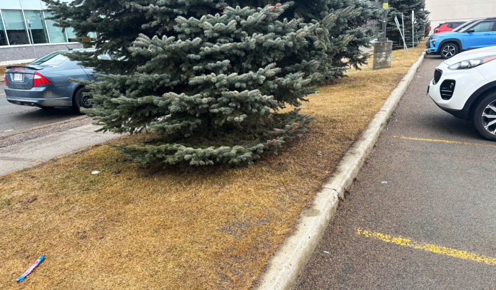
 Experts say northeastern Ontario's major cities had their warmest winter on record – Timmins, North Bay, Sudbury. Sudbury alone received about 30 per cent less snow. (Darren MacDonald/CTV news)
“As a comparison last year last winter from Nov. 20, 2022, through April 2023, we had 15 general callouts. In a typical winter season, we have about 16.”
Overall, Rocca said the city received about 30 per cent less snow this year than average.
“I don't think at any point we could say there was you know, a metre of snow out on the ground when you looked around the community,” he said.
A report headed to the city’s operation committee March 25 bears that out. Sudbury normally receives 38.4 cm if snow in November, this year we received 26.3 cm. The city usually receives 60 cm in December, but got just 16.3 this year.
January was closer to the norm with 74.9 cm, but in February we received about 20 cm less than normal, and March normally sees 34 cm, whereas we have received just 11.9 cm as of March 20.
Kehler said Canadian winters have been trending warmer in recent years, and this year that trend combined with El Nino.
“El Nino has been the big driver of the warm weather, but we're seeing that in Canada, our winters just generally have been getting warmer over time due to Climate Change,” he said.
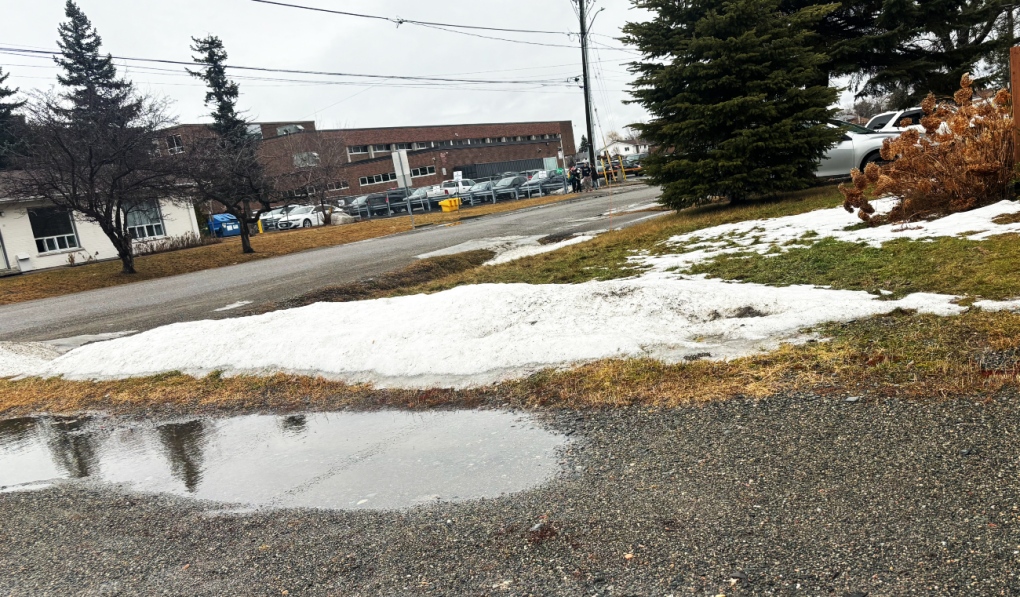
 Experts say northeastern Ontario's major cities had their warmest winter on record – Timmins, North Bay, Sudbury. Sudbury alone received about 30 per cent less snow. (Darren MacDonald/CTV news)
Combined with El Nino
“So when you have El Nino on top of that background warming from Climate Change, that makes it even easier to break these records. And so that's some of what we've been seeing this winter.”
None of the local snow machine dealers we contacted were available for an interview, but Kehler said things are tough all over for snowmobiling this year.
“The west has been very dry for most of this winter,” he said. “We just saw winter storm (recently). That was actually the biggest one of the winter. But up until that point a lot of the Prairies definitely didn't have enough snow to snowmobile for large swathes of the winter.”
While warm winters tend to be dryer, and lead to more forest fires, Kehler said other trends offer some hope. As El Nino weakens, he said rain tends to increase.
“We're actually seeing that El Nino will probably weaken or disappear this summer,” he said.
“That could change weather patterns significantly. It's not uncommon that when an El Nino event is waning, we can start to see precipitation increase again. So I wouldn't say that we're guaranteed to have a bad wildfire season, but you would obviously like to see more precipitation.”
After the record-breaking wildfire season of 2023, the Ministry of Natural Resources said they are actively monitoring conditions in the forest.
“Observations in late January and February suggest that many of the weather stations in northern Ontario have recorded lower than normal overwinter precipitation,” the MNRF said.
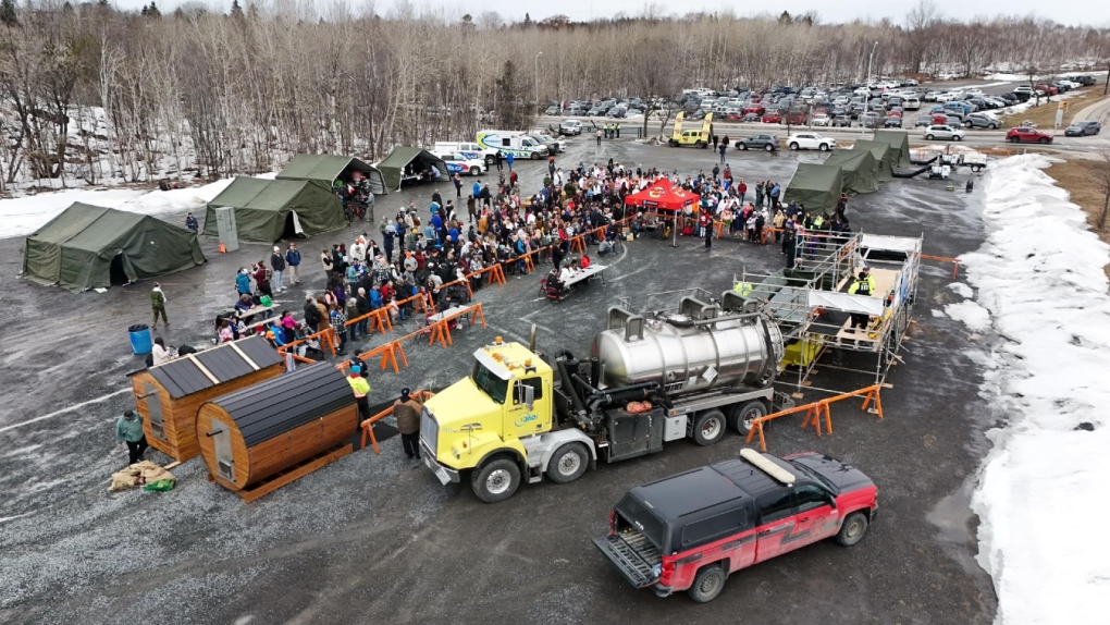
 An overview of the the 2024 Sudbury Polar Plunge on March 2, 2024. Unlike past years, Ramsey Lake wasn't frozen over. (Facebook/Greater Sudbury Police Service)
Long-term trends
“However, there is still time for additional precipitation as we move into spring.”
Longer-term, Kehler said the warming trend will continue, along with more frequent extreme weather events.
“Well, I think warmer winters are pretty much baked in at this point,” he said.
“But the one thing I would point out is that with Climate Change, one impact that starting to become more and more evident is extremes. And so we're getting these extreme dry winters, but on the flip side, we may begin to see a lot of really extremely snowy winters, too, because the jet stream tends to get locked into certain patterns as it weakens from Climate Change.”
So the east coast will likely see more extreme snow storms, while other parts of the country, drought will become more common.
“So you'll get probably some good winters for snowmobiling and then somewhere it's just non-existent,” Kehler said.
“So the trend moving forward is do expect more extreme weather, you know on other end of the spectrum.”
Environment Canada meteorologist Geoff Coulson said one of the more notable aspects of winter this year is how consistently warm it has been.
“There's usually lots of variability -- cold snaps where we get Arctic air coming down,” Coulson said, or freezing rain events.
 Experts say northeastern Ontario's major cities had their warmest winter on record – Timmins, North Bay, Sudbury. Sudbury alone received about 30 per cent less snow. (Darren MacDonald/CTV news)
This winter is 'notably different'
“But this winter has been notably different in that regard, where the mild trend has been consistent through the three months --December January and February.”
This has been one of the more powerful El Nino effects, Coulson said, and it combined with warming trends from Climate Change.
“(For) much of this winter, we've been pulling in more Pacific air masses coming in from Washington State across the northern parts of the U.S., the southern prairies and not really tapping into that really, really cold air up around the Arctic Circle,” he said.
This spring could be trending wetter, Coulson agreed, something he said would help address “the moisture deficit” that started in November.
As far as what to expect, Coulson warned that winter weather could rebound.
“Even though the models are indicating this overall trend to be milder than normal, we still think there's potential for a lot of winter left in the northeast,” he said.
“As we’re heading to April, there’s still lots of potential for some of that cold air to filter down and mix in with these systems and give winter like conditions through the remainder of this month and even into the first part of April. So there's hope for more snowmobiling perhaps at some point.”
- Download our app to get local alerts on your device
- Get the latest local updates right to your inbox
One effect of the warm weather could be an early start to the road construction season.
“I think everyone's ramping up ready to go,” Rocca said.
“We (may be able) get out and start doing some of those more summer activities -- whether it's road construction, line painting, street sweeping -- a little bit earlier than we have in past years.”
CTVNews.ca Top Stories

After warmest on record, winter looks to 'salvage its reputation': Weather Network
Canada's warmest winter on record is unlikely to make a repeat performance this year, The Weather Network's chief meteorologist says, as a new seasonal forecast suggests the season will try to 'salvage its reputation.'
W5 Investigates Canada's least wanted man: A family's long and lonely fight to bring their son home from Syria
Counterterrorism experts and humanitarian groups are urging countries to repatriate suspected ISIS members, as one family tells CTV W5 about their long and lonely fight to bring their son home from Syria.
Israel-Hezbollah ceasefire appears to hold as Lebanese begin streaming south to their homes
A ceasefire between Israel and the Lebanese militant group Hezbollah that began Wednesday appeared to be holding, as residents in cars heaped with belongings streamed back toward southern Lebanon despite warnings from the Israeli and Lebanese militaries that they stay away from certain areas.
Canadians carrying more debt and missing more payments: reports
Interest rate cuts by the Bank of Canada appear to have stimulated spending with more consumers taking on added debt, but as more people take on more credit and car loans there's also been an increase in delinquency rates.
Canada approves Novo Nordisk's obesity drug to reduce risk of non-fatal heart attack
Canada's health regulator has approved Novo Nordisk's weight loss drug Wegovy to reduce the risk of nonfatal heart attack or myocardial infarction in some adults, the Danish drugmaker said on Wednesday.
$30K used as payment in 1990s murder-for-hire plot must be forfeited: B.C. court
A B.C. court has ordered the forfeiture of $30,000 in cash that was seized during a murder-for-hire investigation more than 30 years ago.
N.S. Progressive Conservatives win second majority government; NDP to form opposition
For the second time in a row, Tim Houston's Progressive Conservatives have won a majority government in Nova Scotia. But this time, the NDP will form the official opposition.
A fugitive wanted in the U.S. for a pair of bombings is arrested in the U.K. after 20 years on the run
A suspected animal rights extremist wanted in the U.S. for bombings in the San Francisco area was arrested in Britain after more than 20 years on the run from the law, officials said Tuesday.
Should Canada retaliate if Trump makes good on 25 per cent tariff threat?
After U.S. president-elect Donald Trump threatened to impose a 25 per cent tariff on all Canadian imports on his first day back in the White House unless his border concerns are addressed, there is mixed reaction on whether Canada should retaliate.


