Special weather statements issued in northern Ont. for freezing or heavy rain
Update:
Environment Canada has lifted the thunderstorm watches issued on Saturday for northeastern Ontario – however, has since issued special weather statements warning of freezing or heavy rain from Chapleau, Ont. to Sturgeon Lake, Ont. beginning Sunday evening into Monday afternoon.
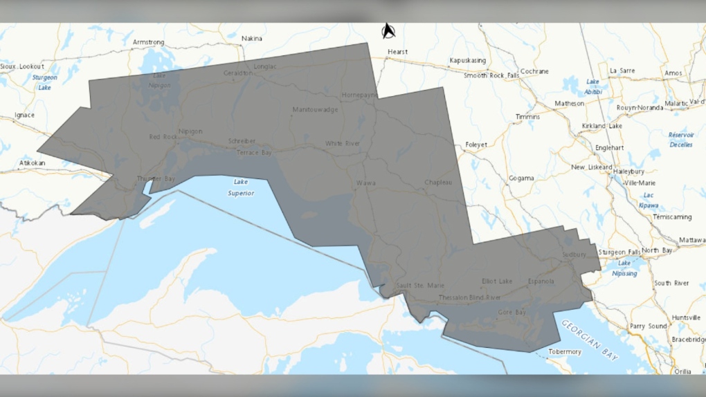 Weather alert map showing special weather statements (grey) in northeastern Ontario as of 5:15 p.m. on April 28, 2024. (Supplied/Environment Canada)
In statements on Sunday , weather forecasters said significant freezing rain or heavy rain is possible into Monday.
Freezing rain
As of 1 p.m., the special weather statement regarding freezing rain were in effect for the communities of Agawa, Beardmore, Black Sturgeon Lake, Caramat, Chapleau, Geraldton, Gull Bay, Hornepayne, Jellicoe, Lake Superior Park, Longlac, Macdiarmid, Manitouwadge, Marathon, Missinaibi Lake, Nipigon, Pukaskwa, Raith, Superior North, Superior West, Thunder Bay, Upsala, Wawa and White River.
“A low pressure system is expected to affect the region and a period of freezing rain and ice pellets is possible,” read the updated statement.
"For most areas freezing rain will be brief before changing to rain or snow, however areas of higher terrain may see freezing rain last slightly longer."
Hazards include ice build-up and icy surfaces due to freezing rain.
Forecasters said that power outages are possible during the weather event and the freezing rain may result in surfaces such as highways, roads, walkways and parking lots becoming slippery.
 An undated file photo of ice formed from freezing rain. (CTV News)
Heavy rain
As of shortly before 1:30 p.m., special weather statements were issued in the communities of Greater Sudbury and area, Manitoulin Island Sault Ste. Marie, Batchawana Bay, Blind River, Elliot Lake, Killarney, Montreal River Harbour, Ranger Lake, Searchmont and St. Joseph Island for heavy rainfall with 20 – 30mm of rain expected from Sunday evening into Monday afternoon or evening.
“A low pressure system will bring another round of rain to the area,”read the statements.
“The ground, already near saturation, has little ability to absorb further rainfall.”
Forecasters said localized flooding in low-lying areas is possible.
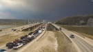
 Several communities in northeastern Ontario are under weather alerts for heavy rain. (File photo/CTV News)
To report severe weather, send an email to ONstorm@ec.gc.ca or tweet reports using #ONStorm.
Original story:
Environment Canada issued a severe thunderstorm watch for several communities in northeastern Ontario on Saturday afternoon – primarily the Greater Sudbury area and West Nipissing.
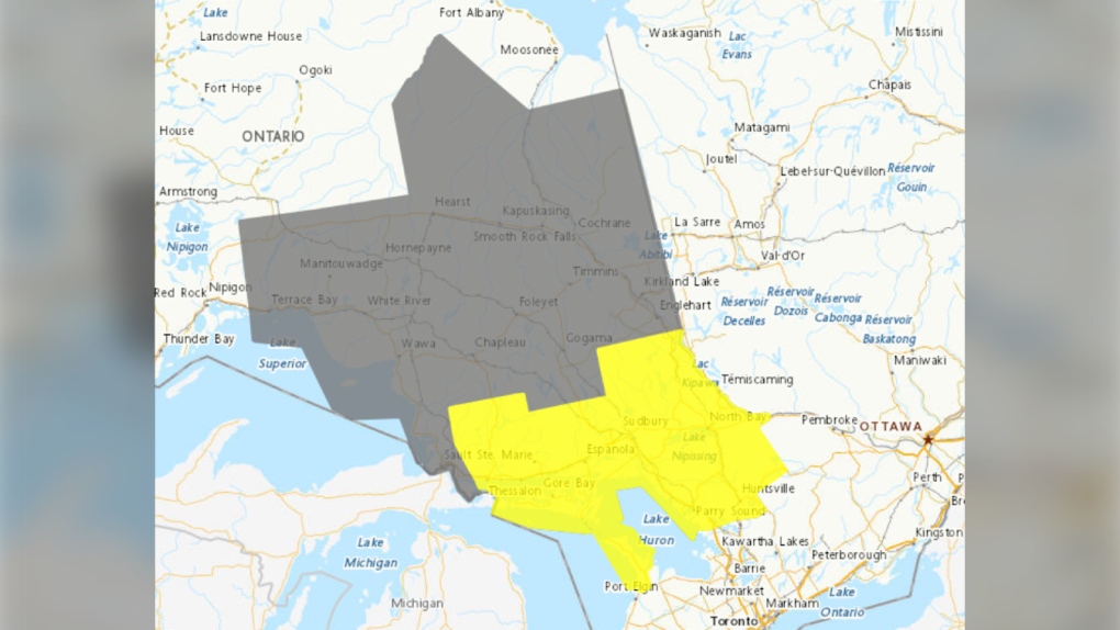 Weather alert map (yellow -- thunderstorm watch and grey -- rainfall weather statement) as of 4:15 p.m. on April 27, 2024. (Supplied/Environment Canada)
The watch includes areas of North Bay, Parry Sound, West Nipissing and Greater Sudbury and vicinity along with the communities of Bayfield Inlet, Blind River, Bruce Peninsula, Burk's Falls, Chapleau, Dunchurch, Elliot Lake, Espanola, French River, Killarney, Manitoulin Island, Mattawa, Missinaibi Lake, Muskoka, North Bay, Powassan, Ranger Lake, Sauble Beach, South River, Temagami, Temiskaming Shores, Thessalon and Tobermory.
This comes as most of the region was already under a special weather statement for rainfall of up to 45mm and flood watches are in effect for most areas affected.
“Conditions are favourable for the development of severe thunderstorms that may be capable of producing large hail and heavy rain,” Environment Canada said in its statements.
Hazards include rapid rainfall of up to 50mm in an hour, twoonie size hail, and flash flooding late Saturday afternoon into the night.
“Large hail can damage property and cause injury,” the statement said.
“Heavy downpours can cause flash floods and water pooling on roads.”
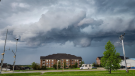
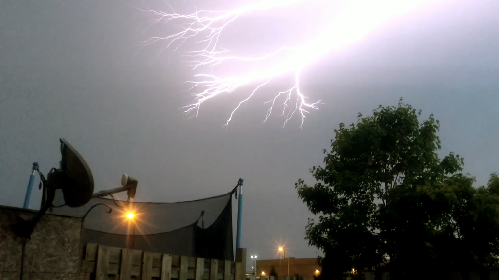 Lightning strikes a North Bay, Ont., sky on June 11, 2017. (File photo/Supplied/Cody Holliday)
Severe thunderstorm watches are issued when atmospheric conditions are favourable for the development of thunderstorms.
“(Storms) could produce one or more of the following: large hail, damaging winds, torrential rainfall,” read the statement.
Emergency Management Ontario recommends that you take cover immediately if threatening weather approaches, said Environment Canada officials.
For more information on how to prepare for an emergency, visit their website.
To report severe weather, send an email to ONstorm@ec.gc.ca or tweet reports using #ONStorm.


CTVNews.ca Top Stories

BREAKING
BREAKING Ontario's 'crypto king' Aiden Pleterski arrested
Aiden Pleterski, the self-proclaimed 'crypto king' from Whitby, Ont., has been arrested in Durham Region after allegedly running a Ponzi scheme worth more than $40 million.
DEVELOPING
DEVELOPING Slovakian prime minister in life-threatening condition after being shot, his Facebook profile says
Slovakia's populist Prime Minister Robert Fico is in life-threatening condition after being wounded in a shooting after a political event Wednesday afternoon, according to his Facebook profile.
BREAKING
BREAKING Quebec court rejects McGill injunction request to remove encampment
A Quebec judge rejected McGill University's request for an injunction to remove the pro-Palestinian encampment on the university's campus in downtown Montreal.
Person responsible for 1996 drugging of 'Titanic' crew likely not a local: Halifax police
Halifax Regional Police believe a non-resident could be responsible for the infamous drugging of numerous crew members of the 'Titanic' movie with a hallucinogenic in 1996.
Ottawa to acquire Quebec Bridge from CN, will spend $1 billion on span over 25 years
The federal government says it has reached a deal with Canadian National Railway Company to acquire the historic Quebec Bridge.
LIVE NOW
LIVE NOW Officials to provide updates on Alberta wildfires on Wednesday after Fort McMurray evacuation
Several news conferences will be held Wednesday morning to update the public on the wildfire situation in Alberta, specifically near Fort McMurray where four neighbourhoods have been evacuated.
'Not a scarient': New COVID-19 subvariant dominant in Canada
A new COVID-19 subvariant is dominant in Canada, representing just over 30 per cent of cases in the country, but infectious disease experts say there’s no sign it’ll evolve into a summer 'scarient.'
WATCH
WATCH Wildfires: Here's who's most at risk when the air quality drops
Wildfires continue to impact air quality across Western Canada with health experts and Environment Canada warning that the smoke from the blazes poses serious risks to human health.
Stormy Daniels' husband says they'll likely leave country if Trump is acquitted
The husband of adult film actress Stormy Daniels said on Tuesday that there’s a 'good chance' the couple will leave the country if former U.S. president Donald Trump is acquitted in his Manhattan criminal trial.
Shopping Trends
The Shopping Trends team is independent of the journalists at CTV News. We may earn a commission when you use our links to shop. Read about us.


Barrie
-

Retired RCAF jets towed to CFB Borden
Residents in Simcoe County were treated to an unusual sight as recently retired Royal Canadian Air Force jet trainers were towed to their new home at 16 Wing/CFB Borden.
-
Man accused of driving erratically while impaired in parking lot arrested
A man accused of driving erratically in an Owen Sound parking lot while impaired was arrested and charged.
-
Here's how the County of Simcoe proposes pushing residents to participate in organics program
The County of Simcoe is proposing introducing measures to ensure residents participate in its organics program after a recent audit revealed that nearly half of the waste tossed into garbage carts didn't belong there.
Toronto
-
BREAKING
BREAKING Ontario's 'crypto king' Aiden Pleterski arrested
Aiden Pleterski, the self-proclaimed 'crypto king' from Whitby, Ont., has been arrested in Durham Region after allegedly running a Ponzi scheme worth more than $40 million.
-
'Not a scarient': New COVID-19 subvariant dominant in Canada
A new COVID-19 subvariant is dominant in Canada, representing just over 30 per cent of cases in the country, but infectious disease experts say there’s no sign it’ll evolve into a summer 'scarient.'
-
Pole fire in Toronto's downtown core leaves thousands without power
A transformer fire in Toronto’s downtown core has left thousands of Toronto Hydro customers without power.
Ottawa
-

Para Transpo driver facing sexual assault charges
A Para Transpo driver is facing charges following an investigation into an alleged sexual assault of a passenger on a transit vehicle last winter.
-
Here is when you will receive an alert during the Alert Ready test in Ottawa and Gatineau
Residents in Ottawa and Gatineau may receive an alert on their smartphones, radios and televisions on Wednesday, as part of a test of Canada's national public alerting system.
-
Small earthquake rattles eastern Ontario, western Quebec
A 3.2 magnitude earthquake was felt east of Ottawa on Wednesday morning.
Kitchener
-
‘It was getting pretty hairy out’: Barn roof torn off during storm in Wellington County
A farmer in Wellington County is cleaning up after the roof of his chicken and turkey barn was torn off in a storm Monday night.
-
Cambridge man arrested for hate-motivated attack on bus: WRPS
Waterloo regional police have arrested a Cambridge man after what they say was a hate-motivated attack on a Grand River Transit Bus.
-
Two Kitchener residents charged with kidnapping and forcible confinement
Two people from Kitchener have been charged as part of a human trafficking investigation in Kitchener.
London
-

Elgin County OPP confirm death of Tanya Wiebe 'a homicide'
More than three months after her death, OPP in Elgin County are confirming the death of Tanya Wiebe was the result of a murder-suicide.
-
'Smoke in the electrical room' closes down London City Hall
London City Hall has been evacuated and will be closed for the remainder of the day after smoke was discovered in the electrical room on Wednesday morning.
-
Province announces inquests into 8 EMDC deaths
Inquests into the deaths of eight men who were in the care of London’s Elgin-Middlesex Detention Centre will be held, the province announced Tuesday.
Windsor
-

Avoid keeping original copies of ownership and insurance documents in vehicle: police
The Windsor police auto theft unit is asking the public to avoid keeping the original copies of ownership and insurance documents in their vehicles.
-
'We probably shouldn't jump to convicting someone': UWindsor legal expert shares insight as murder suspect arrested after repeatedly violating bail conditions
Following the arrest of a 24-year-old murder suspect for repeated bail violations after being charged in 2018, the mother of the murder victim is speaking out, while a University of Windsor professor is urging caution when it comes to Canada’s criminal justice system.
-
Partial lane closures on Lauzon Parkway South
A heads up for drivers who use Lauzon Parkway South, as sewer rehabilitation work will lead to partial lane closures on Wednesday.
Montreal
-
 BREAKING
BREAKING Quebec court rejects McGill injunction request to remove encampment
A Quebec judge rejected McGill University's request for an injunction to remove the pro-Palestinian encampment on the university's campus in downtown Montreal.
-
Man arrested 10 years after Longueuil bike path murder
A 35-year-old man has been arrested in connection with a decade-old murder case.
-
Canadiens goaltender Carey Price to receive honorary doctorate from UNBC
Montreal Canadiens goaltender Carey Price will receive an honorary Doctor of Laws degree from the University of Northern British Columbia on May 31 at the school's convocation ceremony.
Winnipeg
-

Neighbour testifies about late night encounter with admitted serial killer Jeremy Skibicki
Neighbours of admitted serial killer Jeremy Skibicki testified about the man’s late night outings when he was “just getting rid of garbage” – later determined to be the remains of one of his four victims.
-
Winnipeg police release details on assault, arrest in Foodfare incident
Police say a teenager is facing charges after three employees at a Winnipeg grocery store were assaulted with brass knuckles.
-
'I'm just stressed': Birchwood Terrace residents trying to figure out what's next after evacuation order last week
Tenants from Birchwood Terrace are in limbo as many of them are in temporary accommodations and not sure when they'll be allowed back in the building to pick up the rest of their lives.
Atlantic
-

Person responsible for 1996 drugging of 'Titanic' crew likely not a local: Halifax police
Halifax Regional Police believe a non-resident could be responsible for the infamous drugging of numerous crew members of the 'Titanic' movie with a hallucinogenic in 1996.
-
'Sudden death' draws large police presence to Middle Sackville, N.S., neighbourhood
A large police presence in Middle Sackville, N.S., Tuesday night was the result of a sudden death, according to Nova Scotia RCMP.
-
Pockets of showers, chance of thunderstorms in Maritimes Wednesday night and Thursday
A weak weather front will bring scattered showers and a chance of small thunderstorms to the Maritimes Wednesday night and Thursday.
N.L.
-

'Irate male' assaulted Newfoundland officers with block of cheese, police say
Police in Newfoundland say patrol officers were assaulted Thursday by a "very irate male" wielding a block of cheese.
-
Whooping cough outbreak declared in Newfoundland
Health officials say there is an outbreak of whooping cough in eastern Newfoundland.
-
Trucker's body found in trailer in Newfoundland after failed police search in Ontario
Ontario Provincial Police are facing tough questions about their search for a missing Newfoundland trucker whose rig was found two weeks ago in Ontario, then sent back to Newfoundland, where his body was found Monday in the trailer.
Calgary
-

Vehicle with guns inside ditched in Mayland Heights, Calgary police investigating
Calgary police are working to identify two men who are believed to have information about a vehicle recovered from the community of Mayland Heights last year.
-
Best of the best in Calgary tourism awarded with white hats
Twenty tourism and hospitality employees were awarded a white hat, which represents Calgary's western heritage, for their outstanding contributions.
-
Heritage Park ready to welcome back visitors while celebrating 60th anniversary
Calgary's Heritage Park is preparing to open its historical village earlier than ever before.
Edmonton
-
 LIVE NOW
LIVE NOW Officials to provide updates on Alberta wildfires on Wednesday after Fort McMurray evacuation
Several news conferences will be held Wednesday morning to update the public on the wildfire situation in Alberta, specifically near Fort McMurray where four neighbourhoods have been evacuated.
-
Alberta announces the 4 health agencies that will replace AHS later this year
The province has released more information on its plan to break up Alberta Health Services and replace it with four sector-based health agencies.
-
Pickard comes through for Oilers with key saves vs. Canucks
Sometimes third-stringers are the answer.
Regina
-

As Sask. teachers vote on new sanctions mandate, education minister says bargaining is restarting
Negotiations between the provincial government and Saskatchewan Teachers’ Federation (STF) will be restarting on Wednesday, according to the province’s education minister.
-
No injuries reported in 2 overnight Regina house fires
No one was injured in two overnight house fires in Regina that left at least three people displaced.
-
Overtime win moves Warriors to one win away from first ever WHL championship
The Moose Jaw Warriors continued their dominant quest for the Ed Chynoweth Cup on Tuesday night when they sealed a 4-3 overtime victory over the Portland Winterhawks in the Western Hockey League (WHL) Championship series.
Saskatoon
-

Saskatoon mayor delivers final 'State of the City'
More than 300 people gathered at TCU Place as Mayor Charlie Clark delivered his final “State of the City” address for the Greater Saskatoon Chamber of Commerce.
-
As Sask. teachers vote on new sanctions mandate, education minister says bargaining is restarting
Negotiations between the provincial government and Saskatchewan Teachers’ Federation (STF) will be restarting on Wednesday, according to the province’s education minister.
-
More mixed sun and showers coming to Saskatoon
Saskatoon residents can expect a mix of sunshine and showers this week with a chance of thunderstorms on Wednesday and Thursday afternoon.
Vancouver
-

BC United explores common ground and potential deal with surging BC Conservatives
At a news conference about after-school care Tuesday, Premier David Eby seemed preoccupied with the BC Conservatives and its leader John Rustad.
-
B.C. man looks to buy bigger house, do more cooking after $1M Lotto 6/49 win
A Metro Vancouver man says he plans to do more cooking – and buy a bigger home to do it in – after winning $1 million on a Lotto 6/49 draw.
-
2nd out-of-control wildfire approaches Fort Nelson, B.C.
The town of Fort Nelson is on high alert as two out-of-control fires now burn in the area.
Vancouver Island
-
BC United explores common ground and potential deal with surging BC Conservatives
At a news conference about after-school care Tuesday, Premier David Eby seemed preoccupied with the BC Conservatives and its leader John Rustad.
-
B.C. man looks to buy bigger house, do more cooking after $1M Lotto 6/49 win
A Metro Vancouver man says he plans to do more cooking – and buy a bigger home to do it in – after winning $1 million on a Lotto 6/49 draw.
-
2nd out-of-control wildfire approaches Fort Nelson, B.C.
The town of Fort Nelson is on high alert as two out-of-control fires now burn in the area.


