Incoming winter storm prompts weather alerts, cancels all school buses in northeast
Most of northeastern Ontario is under flash freeze and winter storm warnings as a cold front will bring a dramatic drop in temperature Wednesday, prompting school bus cancellations.
Check your school bus route here.
The Rainbow District School Board also rescheduled its Technological Skills Competition at Cambrian College for Thursday.
Weather alerts in effect.
The City of Greater Sudbury has declared a 'significant weather event' as of 11 a.m.
"All roads and sidewalks maintained by the City are considered in a 'state of repair' until further notice," the city said in a news release.
"This declaration is not necessarily a notice of a reduced level of service or a road closure; it is to notify drivers and pedestrians to use an appropriate level of caution when travelling during this event and avoid unnecessary travel."
As a result, road and sidewalk maintenance may take longer than usual, leisure programs, garbage and recycling pick up may be affected, and transit schedules may be delayed.
Flash Freeze warnings
Temperatures are expected to drop rapidly throughout Wednesday morning with a brief period of freezing rain.
"During the transition from rain to snow, some areas may see a brief period of freezing rain and ice pellets. In addition, snowfall amounts up to 5 cm are expected today," the weather alert said.
"Ponding water, slush, and any falling precipitation will freeze as the temperature drops."
Communities along Highway 17 from Blind River to Mattawa are affected along with communities north to Kirkland Lake:
- Blind River
- Bracebridge
- Elliot Lake
- Espanola
- French River
- Greater Sudbury
- Huntsville
- Killarney
- Kirkland Lake
- Manitoulin Island
- Mattawa
- North Bay
- Parry Sound
- Powassan
- Ranger Lake
- Temagami
- Temiskaming Shores
- Thessalon
- West Nipissing
Snow squall warnings
A snow squall warning is in effect for Sault Ste. Marie and St. Joseph Island on Wednesday morning.
The snow squalls are expected to begin Wednesday morning and end Thursday morning, Environment Canada said.
Snowfall of 15 to 25 cm is expected with strong winds gusting 70 to 80 km/h creating reduced visibility.
"Ice pellets and snow will transition to snow squalls this morning with the passage of a strong cold front," the weather alert said.
"Wind will begin to ease late this afternoon or evening. Snow squalls will weaken and move north of the area by early Thursday afternoon."
Travellers are advised to consider postponing trips until conditions improve.
Winter storm warning
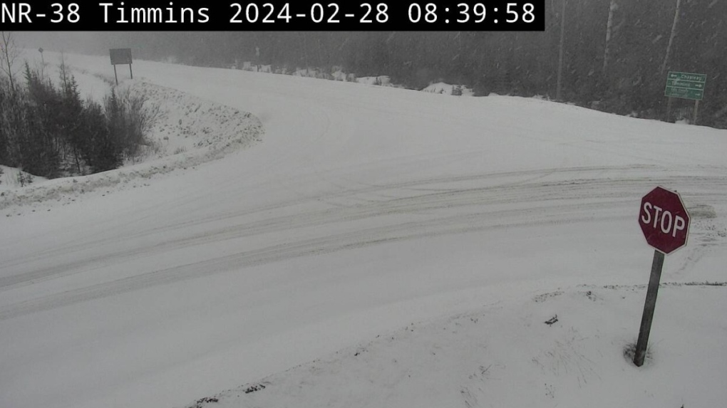
A winter storm is continuing into Wednesday evening and is expected to create dangerous travel conditions with up to 20 cm of snow from Gogama north.
 Snow covered road at Highway 144 and 101 intersection in Timmins. Feb. 28/24 (Ontario 511)
Most communities should see 10 to 15 cm of snow, except Kapuskasing – Hearst will see up to 20 cm with snowfall rates of two to four cm/h.
Gogama to Cochrane is expected to see a period of freezing rain with one to three mm of ice.
" A mix of freezing rain, ice pellets or snow will transition to snow at times heavy this morning," Environment Canada said.
"Temperatures will continue to fall rapidly this morning into the minus teens, leading to the potential of a flash freeze."
Find out how the storm might affect your day.


CTVNews.ca Top Stories

Celine Dion delivers stirring comeback performance at Paris Olympics opening ceremony
Against the rainy Paris night sky, Celine Dion staged the comeback of her career with a powerful performance from the Eiffel Tower to open the Olympic Games.
Jasper wildfire: 'Several weeks' before Jasper can return, premier says
Premier Danielle Smith said Friday afternoon in Hinton while weather conditions are cooler, the Jasper fire is still considered out of control and that Jasper residents can expect to be away from their homes "for several weeks."
Driver charged after flashing high beams at approaching police
Orillia OPP arrested and charged a driver with impaired driving after flashing their high beams.
'He was just gone': Police ramp up search for vulnerable 3-year-old boy in Mississauga, Ont.
Police in Mississauga are conducting a full-scale search of the city’s biggest park for a non-verbal toddler who went missing Thursday evening. Sgt. Jennifer Trimble told reporters Friday morning that there has been no trace of three-year-old Zaid Abdullah since 6:20 p.m., when he was last seen with his parents in Erindale Park, near Dundas Street West and Mississauga Road.
Irish museum pulls Sinead O'Connor waxwork after just one day due to backlash
An Irish museum will withdraw a waxwork of singer-songwriter Sinéad O’Connor just one day after installing it, following a backlash from her family and the public, it told CNN in a statement on Friday.
Turpel-Lafond won't sue CBC over Cree heritage report that took 'heavy toll': lawyer
The lawyer for a former judge whose claims to be Cree were questioned in a CBC investigation says his client is not considering legal action against the broadcaster after the Law Society of British Columbia this week backed her claims of Indigenous heritage.
Winnipeg senior's account overdrawn for $146,000 water bill
A Winnipeg senior is getting soaked with a six figure water bill.
Health Canada warns some naloxone kits contain false instructions
Health Canada is warning some take-home naloxone kits come with bad instructions that should be ignored in favour of the correct guidance.
Paris dazzles with a rainy Olympics opening ceremony on the Seine River
Celebrating its reputation as a cradle of revolution, Paris kicked off its first Summer Olympics in a century on Friday with a rain-soaked, rule-breaking opening ceremony studded with stars and fantasy along the Seine River.
Shopping Trends
The Shopping Trends team is independent of the journalists at CTV News. We may earn a commission when you use our links to shop. Read about us.


Barrie
-

Teen airlifted after car flipped upside down with 2 passengers inside
A 19-year-old driver was airlifted to a trauma center after a crash left one vehicle overturned with two passengers trapped inside.
-
Second person charged in connection to the death of 25-year-old man in Meaford
A second person has been charged in connection to the death of a 25-year-old man in Meaford more than four years ago.
-
Controversery continues in Wasaga Beach after beachgoers defacting in sand
While Wasaga Beach is known for being the longest freshwater beach in the world, it has been talked about for a different reason in recent weeks, as reports have surfaced of beachgoers defecating in the sand.
Toronto
-

'He was just gone': Police ramp up search for vulnerable 3-year-old boy in Mississauga, Ont.
Police in Mississauga are conducting a full-scale search of the city’s biggest park for a non-verbal toddler who went missing Thursday evening. Sgt. Jennifer Trimble told reporters Friday morning that there has been no trace of three-year-old Zaid Abdullah since 6:20 p.m., when he was last seen with his parents in Erindale Park, near Dundas Street West and Mississauga Road.
-
Man wanted after allegedly attempting to grab child in east Toronto
Police are searching for a man who allegedly attempted to grab a child in east Toronto earlier this month.
-
Toronto Zoo shares what led to 2-year-old giraffe’s death
The Toronto Zoo has shared the cause of death for a young giraffe that passed away on Thursday.
Ottawa
-
 BREAKING
BREAKING Former Ottawa Senators assistant coach Bob Jones dies at 54 after battle with ALS
The Ottawa Senators have announced that former assistant coach Bob Jones has died after a battle with ALS. He was 54.
-
Family farm near Christie Lake destroyed by Perth, Ont. tornado
A family in the community of Tay Valley is picking up the pieces of their barn after it was destroyed by Wednesday's tornado near Perth, Ont.
-
Community members in Cornwall, Ont. want 60 more days for asylum seekers to find housing
Community agencies in Cornwall, Ont. are asking the federal government to give asylum seekers more time to find housing, after Immigration, Refugees & Citizenship Canada (IRCC) decided not to renew its contract with the Dev Hotel.
Kitchener
-

Police seek tips in Cambridge armed robbery investigation
Police have shared the photo of a person they’re trying to identify as part of armed robbery investigation in Cambridge.
-
Health Canada warns some naloxone kits contain false instructions
Health Canada is warning some take-home naloxone kits come with bad instructions that should be ignored in favour of the correct guidance.
-
Pierre Poilievre talks international students and safe drug supply at Kitchener stop
Federal Conservative Party Leader Pierre Poilievre toured a Kitchener tech hub on Friday, where he spoke to CTV News Kitchener about his key campaign messages.
London
-

'My ties to this community are done': Jewish London member reacts to being evicted from Jewish Community Centre
Darlene Zaifman-Gustlis was denied entry to an event for Pierre Poiliere at the London Jewish Community Centre.
-
Serious assault turned homicide after victim dies in hospital
The victim of a serious assault that occurred on July 20 has since died in hospital, according to London police.
-
The story behind the Eiffel Tower sculpture inside CF Masonville Place
Art Stokman partnered with CF Masonville Place to enhance their Home of Team Canada Lounge inside the mall in London.
Windsor
-

Doctor identified in alleged newborn data snooping scandal
CTV News has learned the identity of the doctor under investigation for allegedly accessing the data of newborn babies without authorization: Dr. Omar Afandi.
-
Road reopened after train derailment in Puce
Essex County OPP have reopened Old Tecumseh Road, near Puce Road, after a train derailment.
-
Former Spitfires head coach Bob Jones dies after battle with ALS
The Windsor Spitfires have confirmed to CTV News that former head coach Bob Jones has died after a battle with ALS.
Montreal
-
Celine Dion delivers stirring comeback performance at Paris Olympics opening ceremony
Against the rainy Paris night sky, Celine Dion staged the comeback of her career with a powerful performance from the Eiffel Tower to open the Olympic Games.
-
Montrealer living in Jasper hopes home will be spared from fire
As the wildfires continue to rage in Alberta, a Montreal man who has lived in Jasper for over 20 years watches anxiously, hoping his home will be spared.
-
Environmental activists target Montreal airport for third consecutive day
Environmental activists have caused disruptions outside Montreal Trudeau International Airport for three consecutive days protesting Canadian fossil fuel policy.
Winnipeg
-

Winnipeg senior's account overdrawn for $146,000 water bill
A Winnipeg senior is getting soaked with a six figure water bill.
-
Winnipeg Beach Food Cupboard closes
A Winnipeg Beach food bank that expanded this summer and served Interlake residents in need is now closed due to what the founder said was a community council decision.
-
Tornado watch for Kenora and other parts of Ontario
Environment and Climate Canada (ECCC) is cautioning residents that conditions for a tornado are favourable in parts of Ontario.
Atlantic
-

Colin Tweedie sentenced to 4.5 years in prison for hit-and-run death of Cape Breton girl
Colin Tweedie has been sentenced to four-and-a-half years in federal prison in the 2019 hit-and-run death of 10-year-old Cape Breton girl Talia Forrest.
-
Fire burns on roof of NB Power’s natural-gas fired plant in Saint John
Emergency crews in Saint John are responding to a fire burning on the roof at NB Power’s Bayside Generating Station Friday afternoon.
-
Videos online appear to show two recent shark sightings in Nova Scotia waters
Videos circulating online recently appear to show two separate shark sightings in Nova Scotia waters.
N.L.
-

Unclaimed bodies are piling up in Newfoundland. A funeral director blames government
Unclaimed bodies are piling up in Newfoundland, and a funeral director says they likely belong to people whose loved ones couldn't get enough government help to pay for a funeral.
-
Newfoundland refinery operator charged for flash explosion that killed worker
The owner of a refinery in Newfoundland has been charged with health and safety violations for a flash explosion at the plant in 2022 that killed a worker and injured seven others.
-
Transportation Safety Board investigating fire aboard boat abandoned by 'Lucky 7'
The Transportation Safety Board of Canada has sent investigators to Newfoundland to determine what caused a fire aboard a fishing boat that forced the crew to abandon the vessel for a life-raft, leaving them at the mercy of the waves for two days.
Calgary
-

Jasper wildfire: 'Several weeks' before Jasper can return, premier says
Premier Danielle Smith said Friday afternoon in Hinton while weather conditions are cooler, the Jasper fire is still considered out of control and that Jasper residents can expect to be away from their homes "for several weeks."
-
'Best place to come and watch': Olympic FanFest takes over downtown Calgary
Stephen Avenue has transformed into a central hub for Olympic fans to unite and support Team Canada at the 2024 Paris Games.
-
In case of emergency: how to prepare for extreme weather evacuations
The Jasper fire situation is an example of just how quickly a weather event can turn into a disaster — and a good reminder to all Canadians about preparation.
Edmonton
-
Jasper wildfire: 'Several weeks' before Jasper can return, premier says
Premier Danielle Smith said Friday afternoon in Hinton while weather conditions are cooler, the Jasper fire is still considered out of control and that Jasper residents can expect to be away from their homes "for several weeks."
-
New numbers confirm one-third of Jasper townsite destroyed in this week's wildfire
One-third of all structures in the townsite of Jasper are gone, burned to the ground in this week’s wildfire, officials confirmed Friday.
-
Man found guilty in fatal Alberta school stabbing
The man accused of killing his 17-year-old classmate, Jennifer Winkler, was found guilty of second-degree murder on Friday.
Regina
-

Sask. man dead after collision involving truck and train
A 63-year-old man from Cowessess First Nation has died following a collision involving a truck and a train on Range Road 2060 in the RM of Elcapo.
-
Hot and dry week in Sask. leads to decline of crop conditions
A hot and dry week in Saskatchewan has led to the decline of crop conditions, especially in the southern and western parts of the province, according to the province’s latest crop report.
-
Regina's Wascana Pool closed due to mechanical issues
Regina’s Wascana’s Pool has been closed due to mechanical issues since Wednesday.
Saskatoon
-

How a Sask. city changed the way the Crime Severity Index is reported
A small city in Saskatchewan has helped affect big changes in the way Statistics Canada reports its annual Crime Severity Index (CSI) data.
-
Sask. appeal court says anti-trans group cannot join constitutional dispute over pronoun law
Saskatchewan’s Court of Appeal has denied a political group that opposes so-called “gender ideology” intervener status in a legal dispute over the province’s controversial pronoun law.
-
7-year-old boy bear sprayed in string of attacks sparks ‘concern’ from Saskatoon police
The Saskatoon Police Service (SPS) says it’s taking bear spray attacks seriously after a string of incidents, one including a 7-year-old boy, earlier this week.
Vancouver
-

Pedestrian struck, killed by train in Surrey, RCMP say
A man is dead after being struck by a train in Surrey Friday morning, according to local Mounties.
-
Mounties say B.C. father missing with 4 children in violation of court order
Police in the British Columbia Interior are searching for a father and his four young children after the man failed to surrender the children to their mother, in violation of a court order.
-
Property management company's licence suspended, accounts frozen in 'urgent' BCFSA order
The B.C. Financial Services Authority has frozen a property management company's trust accounts and suspended its licence after what the regulator calls "repeated failures to provide compliant financial records."
Vancouver Island
-

Vancouver Island wildfire expected to grow until rain, cooler temperatures arrive
Wildfire officials on Vancouver Island say an out-of-control wildfire burning west of Victoria is expected to grow in the coming days before rain and cooler temperatures can help firefighters gain an upper hand on the blaze.
-
Mounties say B.C. father missing with 4 children in violation of court order
Police in the British Columbia Interior are searching for a father and his four young children after the man failed to surrender the children to their mother, in violation of a court order.
-
B.C. port employers say foremen's union plans industry-wide strike vote
The BC Maritime Employers Association says it has been told by a lawyer for the foremen's union that an industry-wide strike vote will take place in coming weeks.


