Video shows northern Ont. storm hammer shoreline, breaking dock
The owner of a northern Ont. camp is continuing to clean up after an intense storm that prompted a tornado warning Thursday ripped through the area breaking his dock and downing trees.
Trevor Graydon of Mowat Landing Cottages on the Montreal River in New Liskeard, near the Quebec border, captured video of the rain, hail and heavy winds pummelling his shoreline the afternoon of June 13.
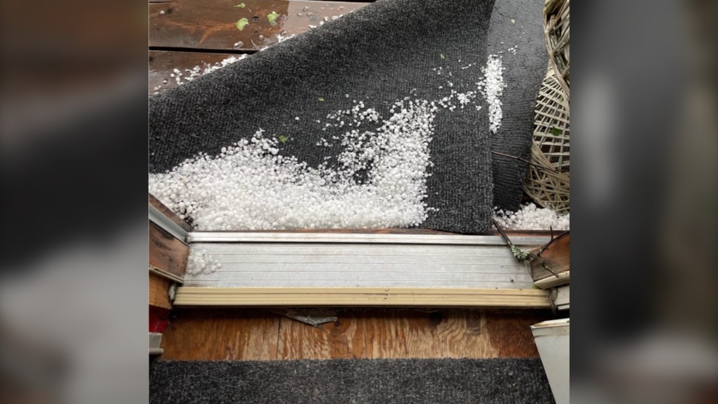
The fast-moving storm brought severe thundershowers to the area and prompted Environment Canada to issue weather alerts shortly before 3 p.m. warning of nickel- to ping pong ball-sized hail and up to 90 km/h wind gusts.
Heavy rain and wind pushing waves ashore on the usually peaceful waters can be seen intensifying before swirling and flying debris takes flight in the nearly two-minute video.
"Never seen an aqua blue sky like that," Graydon said in a post on social media.
Melanie Aquino Ducharme commented that the sky turned aqua blue, orange and fuschia in Haileybury during the storm.
A float plane can be seen docked at the beginning of the video footage and appears to end up along the shoreline after the dock breaks off and washes ashore.
 Storm damage in New Liskeard, Ont.
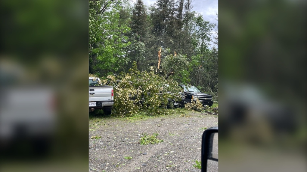
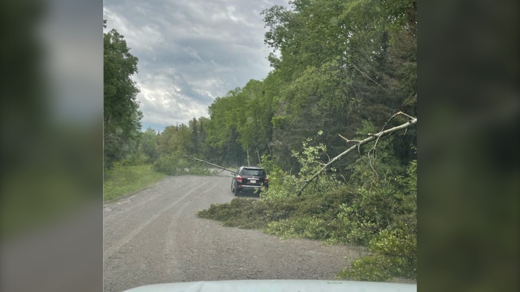
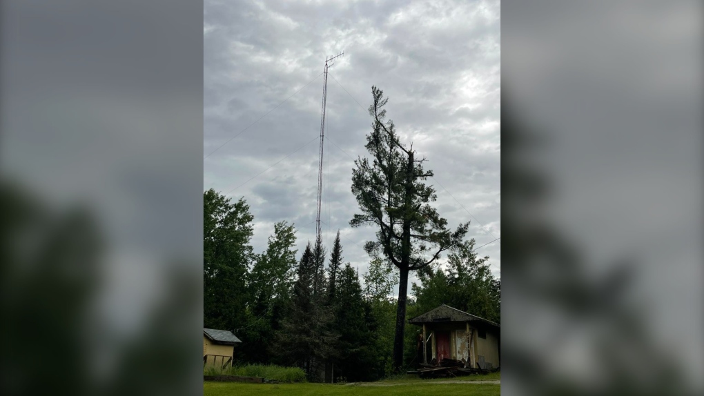
Several trees around the property were taken out by the storm and caused damage to some vehicles, Graydon said.
 Storm damage in New Liskeard, Ont.
 Storm damage in New Liskeard, Ont.
 Storm damage in New Liskeard, Ont.
One of the downed trees was 160 feet tall, he said, but luckily, no one was injured and the plane is OK.
 Storm damage in New Liskeard, Ont.
PHOTO GALLERY: Damage left behind at Mowat Landing Cottages
The roads are cleared as of Saturday afternoon and cleanup is almost done, Graydon added.
His video of the storm posted on social media has garnered more than 26,000 views.
 Storm damage in New Liskeard, Ont.
Lesley Elliott, a research meteorologist for the Northern Tornadoes Project, told CTV News in an email that based on the video, the storm looks like a weak downburst.
"We have been reviewing witness and damage reports from the storms on the 13th and will start reviewing satellite imagery of the storm tracks as it becomes available," Elliott said.
"We have seen the report of trees down nearby and this is an area slated for satellite imagery review as well. Once we have enough information, we should be able to estimate a max. wind speed based on the damage."
Two Ontario tornadoes
No tornadoes have been confirmed yet as a result of Thursday's storm, but the Northern Tornadoes Project is reporting two 'over land' tornadoes earlier in June.
One reportedly happened June 4 in the northwest around 6:35 p.m.
"Satellite imagery review of a storm track of interest revealed tornado damage in forested areas near Landings Lake, north of Lac Seul," NTP said in its map.
"Tornado damage is assessed as EF2, with an estimated max wind speed of 190 km/h, track length of 5.67 km and max path width of 350 m.
On the afternoon of June 6, an EF0 tornado was recorded south of Ottawa.
"A tornado caused weak tree and crop damage south of Spencerville, where a section of the damage track was documented by a private citizen," NTP said.
"No injuries were reported."
A ground and drone survey was completed by NTP over the two days following the storm.
The tornado had an estimated max wind speed of 115 km/h, track length of 6.83 km and max path width of 250 m.
CTVNewsNorthernOntario.ca has reached out to the Northern Tornadoes Project about Thursday's storm and is awaiting a response.
CTVNews.ca Top Stories

'Mayday! Mayday! Mayday!': Details emerge in Boeing 737 incident at Montreal airport
New details suggest that there were communication issues between the pilots of a charter flight and the control tower at Montreal's Mirabel airport when a Boeing 737 made an emergency landing on Wednesday.
Trudeau appears unwilling to expand proposed rebate, despite pressure to include seniors
Prime Minister Justin Trudeau does not appear willing to budge on his plan to send a $250 rebate to 'hardworking Canadians,' despite pressure from the opposition to give the money to seniors and people who are not able to work.
Hit man offered $100,000 to kill Montreal crime reporter covering his trial
Political leaders and press freedom groups on Friday were left shell-shocked after Montreal news outlet La Presse revealed that a hit man had offered $100,000 to have one of its crime reporters assassinated.
Cucumbers sold in Ontario, other provinces recalled over possible salmonella contamination
A U.S. company is recalling cucumbers sold in Ontario and other Canadian provinces due to possible salmonella contamination.
Trudeau says no question incoming U.S. president Trump is serious on tariff threat
Prime Minister Justin Trudeau says incoming U.S. president Donald Trump's threats on tariffs should be taken seriously.
In a shock offensive, insurgents breach Syria's largest city for the first time since 2016
Insurgents breached Syria's largest city Friday and clashed with government forces for the first time since 2016, according to a war monitor and fighters, in a surprise attack that sent residents fleeing and added fresh uncertainty to a region reeling from multiple wars.
Canada Bread owner sues Maple Leaf over alleged bread price-fixing
Canada Bread owner Grupo Bimbo is suing Maple Leaf Foods for more than $2 billion, saying it lied about the company's involvement in an alleged bread price-fixing conspiracy.
John Herdman resigns as head coach of Toronto FC
John Herdman, embroiled in the drone-spying scandal that has dogged Canada Soccer, has resigned as coach of Toronto FC.
Musk joins Trump and family for Thanksgiving at Mar-a-Lago
Elon Musk had a seat at the family table for Thanksgiving dinner at Mar-a-Lago, joining President-elect Donald Trump, Melania Trump and their 18-year-old son.


