Heavy snow, high winds expected to hit northeastern Ontario this weekend
 Environment Canada has a special weather statement regarding heavy snow and winds expected to hit the region beginning Saturday in Sault Ste. Marie, extending into other areas Sunday, and extending into Monday. (File)
Sudbury -
Environment Canada has a special weather statement regarding heavy snow and winds expected to hit the region beginning Saturday in Sault Ste. Marie, extending into other areas Sunday, and extending into Monday.
The area around Sault Ste. Marie could see 15-25 cm of snow beginning Friday and continuing Saturday.
"Hazardous travel conditions due to accumulating snow and poor visibility in bursts of heavy snow," Environment Canada said in its statement.
"Warnings may be required as the event draws nearer."
Other areas will be hit by the storm Sunday. Communities affected include: Greater Sudbury, Elliot Lake, Ranger Lake, Agawa, Timmins, Cochrane, Iroquois Falls, North Bay, Powassan, Mattawa, West Nipissing, French River, Kirkland Lake, Englehart, Temiskaming Shores, Temagami, Wawa, Pukaskwa Park, Chapleau, Missinaibi Lake, Gogama, Foleyet, Blind River, Thessalon, Espanola, Killarney and Manitoulin Island.
"Winter storm expected Sunday afternoon through Monday," Environment Canada said. "Heavy snow. Total snowfall accumulations of 10 to 25 cm. Strong winds with gusts of 60 to 70 km/h and risk of freezing rain for some areas."
Other areas will receive heavy rain and hazardous travel conditions are expected.
"A strengthening low-pressure system is expected to track east across the Great Lakes Sunday through Monday," the weather forecaster said.
"There remains some uncertainty in the track of this low-pressure system and as a result, the snowfall amounts and areas affected by freezing rain and heavy rain could change. At this time, areas north and west of Sudbury are expected to receive mainly snow, whereas areas east and south of Sudbury could see a wintry mix of precipitation. Warnings will be issued as the event draws nearer."


CTVNews.ca Top Stories

LIVE NOW
LIVE NOW Budget 2024 prioritizes housing while taxing highest earners, deficit projected at $39.8B
In an effort to level the playing field for young people, in the 2024 federal budget, the government is targeting Canada's highest earners with new taxes in order to help offset billions in new spending to enhance the country's housing supply and social supports.
BUDGET 2024
BUDGET 2024 Feds cutting 5,000 public service jobs, looking to turn underused buildings into housing
Five thousand public service jobs will be cut over the next four years, while underused federal office buildings, Canada Post properties and the National Defence Medical Centre in Ottawa could be turned into new housing units, as the federal government looks to find billions of dollars in savings and boost the country's housing portfolio.
Some of the winners and losers in the 2024 federal budget
With a variety of fiscal and policy measures announced in the federal budget, winners include small businesses and fintech companies while losers include the tobacco industry and Canadian pension funds.
From housing initiatives to a disability benefit, how the federal budget impacts you
From plans to boost new housing stock, encourage small businesses, and increase taxes on Canada’s top-earners, CTVNews.ca has sifted through the 416-page budget to find out what will make the biggest difference to your pocketbook.
Police to announce arrests in Toronto Pearson airport gold heist
Police say that arrests have been made in connection with a $20-million gold heist at Toronto Pearson International Airport one year ago.
Teen hockey players arrested for sexual assault following hazing incident: Manitoba RCMP
Three teenagers were arrested in connection with a pair of alleged hazing incidents on a Manitoba hockey team, police say.
'I Google': Why phonebooks are becoming obsolete
Phonebooks have been in circulation since the 19th century. These days, in this high-tech digital world, if someone needs a phone number, 'I Google,' said Bridgewater, N.S. resident Wayne Desouza.
Liberals aim to hit the brakes on car theft with new criminal offences
The Liberals are proposing new charges for the use of violence while stealing a vehicle and for links to organized crime, as well as laundering money for the benefit of a criminal organization.
BUDGET 2024
BUDGET 2024 Ottawa police get $50 million to boost security around Parliamentary Precinct
The Ottawa Police Service will receive $50 million in new federal funding over the next five years to "enhance security" around the Parliamentary Precinct.
Shopping Trends
The Shopping Trends team is independent of the journalists at CTV News. We may earn a commission when you use our links to shop. Read about us.


Barrie
-

Casino Rama adds new shows to its 2024 performance lineup
Two new shows are coming to Casino Rama's Entertainment Centre for fans of country music and 80s rock.
-
Apartment fire linked to battery-operated vacuum cleaner
Fire officials say a lithium-ion battery inside a vacuum cleaner sparked a fire at an apartment complex Sunday afternoon in Gravenhurst.
-
Glenn Howard, iconic Canadian curler, announces retirement
One of the nation's most beloved and decorated curlers, Glenn Howard, officially announced his retirement on Tuesday.
Toronto
-

Police to announce arrests in Toronto Pearson airport gold heist
Police say that arrests have been made in connection with a $20-million gold heist at Toronto Pearson International Airport one year ago.
-
WATCH
WATCH Toronto woman has close encounter with coyote near Ontario Place
A Toronto woman is warning others to be on the lookout after a coyote approached her while she was sitting on a park bench near Ontario Place last weekend.
-
Ontario asks feds to close loophole that’s led to 'disturbing' rise in pay for care clinics
Ontario’s Minister of Health is asking her federal counterpart to help close a loophole she says has led to a “disturbing” rise in clinics charging for access to primary care.
Ottawa
-
 BUDGET 2024
BUDGET 2024 Feds cutting 5,000 public service jobs, looking to turn underused buildings into housing
Five thousand public service jobs will be cut over the next four years, while underused federal office buildings, Canada Post properties and the National Defence Medical Centre in Ottawa could be turned into new housing units, as the federal government looks to find billions of dollars in savings and boost the country's housing portfolio.
-
BUDGET 2024
BUDGET 2024 New funding for NAC, no cash for OC Transpo in federal budget
CTVNewsOttawa.ca looks at four things in the federal budget that will have an impact on the city of Ottawa.
-
BUDGET 2024
BUDGET 2024 Ottawa police get $50 million to boost security around Parliamentary Precinct
The Ottawa Police Service will receive $50 million in new federal funding over the next five years to "enhance security" around the Parliamentary Precinct.
Kitchener
-

Infrastructure, housing investments among budget highlights for local mayors
The mayors of Kitchener and Waterloo are weighing in on the federal government’s 2024 budget.
-
Grand River Rocks time in new home is limited
Grand River Rocks will have limited time in their new home on Victoria Street North, after Kitchener City Council officially approved the rezoning of the property to allow for a condo development.
-
‘They need to come down’: Christmas decorations still up on city property in Cambridge, Waterloo
Many people have their sights set on summer, but it seems some spots in Waterloo Region are stuck in another season.
London
-
 BREAKING
BREAKING Fatal crash on Highway 401 claims 1 life, eastbound lanes closed
A two-vehicle crash between a pickup truck and a transport truck on Highway 401 in London, Ont. has resulted in one fatality Tuesday afternoon, with police warning motorists to expect delays in the area.
-
'It’s pretty messed up': Vaping and vandalism continue to impact high school students and staff across the region
It’s an issue affecting local high schools across the Thames Valley District School Board (TVDSB) and the London District Catholic School Board (LDCSB).
-
'Not worth it': London, Ont. driver charged after travelling nearly 200 km/h on Highway 401
A driver from London will have to find alternative transportation after an OPP officer clocked them travelling nearly 200 km/h on Highway 401 over the weekend.
Windsor
-

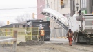
'Spring has been fantastic': Early start to road construction season in Essex County
County of Essex officials said construction season has arrived and in some cases started early this year thanks to the warm weather this spring.
-
Landlord group to appeal court decision over residential rental bylaw
A group of landlords contesting the city’s new residential rental licensing bylaw is appealing a recent court decision.
-
LIVE NOW
LIVE NOW Budget 2024 prioritizes housing while taxing highest earners, deficit projected at $39.8B
In an effort to level the playing field for young people, in the 2024 federal budget, the government is targeting Canada's highest earners with new taxes in order to help offset billions in new spending to enhance the country's housing supply and social supports.
Montreal
-

Quebec's refusal to deliver English presentation to parents raises questions about language law
Quebec's education ministry says it is working on clarifying directives on when officials can communicate with the public in a language other than French.
-
Liberals plan to convert some Montreal office buildings into housing under federal budget
The federal government plans to convert some government office buildings into housing, including some in Quebec, and to leasing federal land, according to the budget announced Tuesday.
-
Teenagers' screen time has dropped post-pandemic: Montreal Public Health
Teenagers are showing post-pandemic improvements when it comes to screen time, according to a new study published Tuesday by Montreal Public Health.
Winnipeg
-

Teen hockey players arrested for sexual assault following hazing incident: Manitoba RCMP
Three teenagers were arrested in connection with a pair of alleged hazing incidents on a Manitoba hockey team, police say.
-
LIVE NOW
LIVE NOW Budget 2024 prioritizes housing while taxing highest earners, deficit projected at $39.8B
In an effort to level the playing field for young people, in the 2024 federal budget, the government is targeting Canada's highest earners with new taxes in order to help offset billions in new spending to enhance the country's housing supply and social supports.
-
'It's troubling': Winnipeg sports memorabilia store target of three break-ins
One Winnipeg sports memorabilia shop has been the target of multiple break-ins and is now looking to recover some stolen property.
Atlantic
-

500 Newfoundlanders wound up on the same cruise and it turned into a rocking kitchen party
A Celebrity Apex cruise to the Caribbean this month turned into a rocking Newfoundland kitchen party when hundreds of people from Canada's easternmost province happened to be booked on the same ship.
-
4 people charged in connection with N.S. man’s 2022 death
The Nova Scotia RCMP says four people have been charged following a man’s homicide two years ago.
-
Halifax Transit bus involved in three-vehicle crash in city’s downtown
A portion of Barrington Street has reopened after a three-vehicle crash Tuesday morning.
N.L.
-
500 Newfoundlanders wound up on the same cruise and it turned into a rocking kitchen party
A Celebrity Apex cruise to the Caribbean this month turned into a rocking Newfoundland kitchen party when hundreds of people from Canada's easternmost province happened to be booked on the same ship.
-
Protest averted as Newfoundland and Labrador premier helps reach pricing deal on crab
A pricing agreement has been reached between crab fishers and seafood processors that will allow for Newfoundland and Labrador's annual crab fishery to get started.
-
A fish harvester's protest threatens Newfoundland and Labrador's crab season -- again
Longliners across Newfoundland and Labrador are tied up once again, as a new protest by the province's fish harvesters threatens to derail the crab fishery for a second straight year.
Calgary
-

Calgary councillor tables motion to double speeding fines in playground zones
A motion before Calgary councillors wants the provincial government to consider doubling the fines for speeding through a playground or school zone across Alberta.
-
Kingpins or go-betweens? Jurors hear closing arguments in Coutts blockade trial
A Crown prosecutor making the case against three men charged with mischief at the border blockade at Coutts, Alta., told jurors Tuesday they don’t have to determine the accused were kingpins of the protest in order find them guilty.
-
Extended construction in Marda Loop creates further financial concern among businesses
Marda Loop business owners are expressing concern over revenue losses after the City of Calgary announced construction in the area is expected to continue several months longer than planned.
Edmonton
-

Edmonton Zone health staff sound alarm over capacity for babies in intensive care
Staff caring for frail babies at hospitals in the Edmonton area are asking for help from the province.
-
$440K in stolen property recovered by RCMP during rural crime investigation
Three people have been charged after police recovered nearly half a million dollars worth of stolen property.
-
Crews battle fire at northeast Edmonton business
Fire damaged a Fort Road commercial building on Tuesday afternoon.
Regina
-

Parts of Sask. could see up to 30 centimetres of snow, dangerous driving conditions: ECCC
Winter weather seemed to be in the rear view mirror for Saskatchewan the past couple weeks, but now Environment and Climate Change Canada (ECCC) is forecasting as much as 30 centimetres of snow for some parts of the province.
-
HRF, Municipal Hail Insurance teaming up to bring latest technology to Regina General Hospital
Municipal Hail Insurance and the Hospitals of Regina Foundation (HRF) has teamed up to raise money for upgrades to the Mosaic Heart Centre at the Regina General Hospital (RGH).
-
Yorkton woman left breathless after winning $100,000
A Yorkton woman is still catching her breath after reporting a $100,000 lotto win.
Saskatoon
-

Sask. real estate company that lost investors' millions reaches settlement
The founders of a Saskatoon real estate investment company that left investors with millions of dollars in losses have reached a settlement with Saskatchewan’s financial and consumer watchdog.
-
Guilty pleas entered in beating of mentally ill man on Saskatchewan farm
Two men accused of beating and tying up a mentally ill man on a Saskatchewan farm have pleaded guilty to assault causing bodily harm.
-
Parts of Sask. could see up to 30 centimetres of snow, dangerous driving conditions: ECCC
Winter weather seemed to be in the rear view mirror for Saskatchewan the past couple weeks, but now Environment and Climate Change Canada (ECCC) is forecasting as much as 30 centimetres of snow for some parts of the province.
Vancouver
-

B.C. killer seeks to attend sentencing by video as lawyer cites safety concerns
A defence lawyer for Ibrahim Ali, who was convicted of first-degree murder of a 13-year-old girl in Burnaby, B.C., says the man wants to appear at his sentencing hearing by video over fear for his safety.
-
'If not you, who?': British Columbians asked to share medical wishes with loved ones
If you were in a medical emergency, would someone you trust be able to communicate your wishes if you couldn't speak for yourself?
-
Unifor withdraws Amazon union applications, citing 'suspiciously high' employee data
Unifor says it’s temporarily withdrawing its applications to represent workers at two Vancouver-area Amazon facilities, accusing the e-commerce giant of providing a “suspiciously high” employee count.
Vancouver Island
-

Relocated seal returns to Greater Victoria after 'astonishing' 204-kilometre trek
A moulting seal who was relocated after drawing daily crowds of onlookers in Greater Victoria has made a surprise return, after what officials described as an 'astonishing' six-day journey.
-
Manslaughter conviction upheld after B.C. man cites claustrophobia in fatal Costco altercation
British Columbia's highest court has upheld a manslaughter conviction against a Vancouver man who shoved a senior outside a busy Costco store, rejecting his argument that the trial judge failed to consider how his claustrophobia and fear of crowds led to the fatal altercation.
-
LIVE NOW
LIVE NOW Budget 2024 prioritizes housing while taxing highest earners, deficit projected at $39.8B
In an effort to level the playing field for young people, in the 2024 federal budget, the government is targeting Canada's highest earners with new taxes in order to help offset billions in new spending to enhance the country's housing supply and social supports.


