Freezing rain, snowfall warnings issued for much of northeastern Ontario
 Freezing rain turns to ice on a car window in Barrie, Ont. (KC Colby/CTV News)
Sudbury -
Several communities in northeastern Ontario are under weather warnings Friday, with either heavy snowfall or freezing rain expected.
The freezing rain warning is in effect for Greater Sudbury, North Bay, Powassan, Mattawa, West Nipissing, French River, Kirkland Lake, Englehart, Temiskaming Shores, Temagami Blind River and Thessalon.
Environment Canada said those communities should expect freezing rain Saturday morning, as well as 5-10 cm of snow.
"A strengthening low-pressure system is forecast to track northeast across the Great Lakes on Saturday, bringing a mix of precipitation to much of northeastern Ontario," the weather forecaster said in a statement.
"Precipitation is expected to begin as snow tonight and transition freezing rain early Saturday morning. Freezing rain will change to rain late Saturday morning and then back to snow Saturday afternoon."
Strong winds are also a possibility, with gusts between 70-80 km/h.
A winter storm warning is in effect for these communities: Sault Ste. Marie, St. Joseph Island, Searchmont, Montreal River Harbour, Batchawana Bay, Timmins, Cochrane, Iroquois Falls, Elliot Lake, Ranger Lake, Gogama, Foleyet, Agawa, Lake Superior Park, Little Abitibi and Kesagami Lake.
Heavy snow -- between 10-20 cm -- mixed with freezing rain, should begin Saturday morning, Environment Canada said.
"Precipitation will begin as snow tonight before becoming mixed with freezing rain or rain Saturday morning or early afternoon," the statement said.
"Precipitation will change back to snow Saturday afternoon and then end in the evening."


CTVNews.ca Top Stories

TD penalties expected to be higher on alleged drug money laundering link: analyst
A banking analyst says TD Bank Group could be hit with more severe penalties than previously expected after a report that the investigation it faces in the U.S. is tied to laundering illicit fentanyl profits.
DEVELOPING
DEVELOPING Foreign interference inquiry to report today on alleged meddling in federal elections
A federal commission of inquiry into foreign interference is slated to release a report today on alleged meddling in the last two general elections.
Magnitude 4.8 earthquake recorded west of Vancouver Island
A 4.8-magnitude earthquake was reported west of Vancouver Island Thursday evening.
Biscuits with possible plastic pieces, metal found in ground pork: Here are the recalls for this week
Here are the latest recalls Canadians should watch out for, according to Health Canada and the Canadian Food Inspection Agency.
How falling for a stranger she met on a beach led this woman to ditch the U.S. for the French Riviera
Niki Benjamin, from the U.S., had travelled to a paradise island to do some soul searching, and her life ended up going in a very different direction when her dog ran up to a stranger.
Britney Spears 'home and safe' after paramedics responded to an incident at the Chateau Marmont, source tells CNN
A source close to singer Britney Spears tells CNN that the pop star is 'home and safe' after she had a 'major fight' with her boyfriend on Wednesday night at the Chateau Marmont in West Hollywood.
Princess Anne to take part in B.C. ceremony bringing new ship into Pacific fleet
Western Canada's first Arctic and Offshore Patrol Vessel will officially be brought into the Pacific fleet today and Princess Anne, the sister of King Charles, is scheduled to take part in its commissioning ceremony.
BREAKING
BREAKING Winnipeg man accused of killing four women will be tried by jury
A Winnipeg man accused of killing four Indigenous women will have his case heard by a jury.
Wally, the emotional support alligator once denied entry to a baseball game, is missing
Emotional support animal registrations in the United States reached 115,832 last year, by an industry group’s count. But in the eyes of reptile rescuer Joie Henney, there’s only one: 'Wally Gator.'
Shopping Trends
The Shopping Trends team is independent of the journalists at CTV News. We may earn a commission when you use our links to shop. Read about us.


Barrie
-

30 firefighters battled the blaze of Bracebridge facility
On Thursday night, 30 firefighters battled a destructive fire that broke out in a facility in Bracebridge Ont.
-
Barrie police arrest man after reports of possibly armed suspect making threats
Barrie officers made an arrest after receiving reports on Thursday afternoon that a possibly armed man made threatening gestures at a Dunlop Street East business owner.
-
Owen Sound Attack part ways with coaching staff
After a lacklustre season for the Owen Sound Attack, the team has parted ways with their top two coaches.
Toronto
-

Suspect arrested in string of shootings outside Toronto-area movie theatres: police
Police say they have arrested a man wanted in connection with a string of shootings outside movie theatres across the GTA.
-
Toronto drivers to be impacted by slew of road closures this weekend
Drivers in Toronto may have to navigate multiple road closures this weekend as a result of construction, special events and filming.
-
Feds giving Toronto more than $104M to host 2026 FIFA World Cup
The federal government will provide Toronto just over $104 million in funding to host the 2026 FIFA World Cup.
Ottawa
-

Forcing public servants back to downtown Ottawa harms satellite communities: North Grenville mayor
The mayor of North Grenville, just south of Ottawa, says hybrid work has been a boon to her community, and a recent move by the federal government to force public servants back to downtown Ottawa office buildings is misguided.
-
Mobile mammography unit coming to Gatineau Hospital to reduce waiting lists
Waiting lists for mammography screening will be reduced, as a mobile mammography screening unit opens to the public in the Outaouais region.
-
18-year-old man facing charges after teenager,15, stabbed during lunch-hour fight in Nepean
An 18-year old man is facing charges after a 15-year-old youth was taken to hospital in critical condition following a stabbing that happened in Nepean Thursday, the Ottawa Police Service says.
Kitchener
-

Large barn fire in Elmira
Three Bridges Road is closed as emergency crews respond to what police say is a “large barn fire” in Elmira.
-
New Hamburg, Ont. family can't get truck's faulty transmission fixed due to aftermarket attachment
A New Hamburg family is feeling deflated after buying a new Toyota hybrid truck.
-
Pedestrian seriously hurt, driver at large following Waterloo crash
Waterloo regional police are looking for a driver involved in a crash that left a pedestrian with serious injuries.
London
-

Three people in hospital following crash east of London, Ont.
A two-vehicle crash involving a transport truck and a passenger vehicle closed Dundas Street, just west of Thamesford, late Thursday afternoon.
-
Fatal crash in South-West Oxford Township
Around 6:45 p.m. on Thursday, first responders were called to the scene near the intersection of Pigram Road and Salford Road in South-West Oxford Township.
-
Clean up outside derelict building doesn’t quell concerns about trespassing and fire risk
Despite a recent clean-up around the former St. Pierre Renovation Centre, concern persists about trespassing and the risk of fire at the former industrial building.
Windsor
-

Two people exchange gunfire in Leamington parking lot
Essex County OPP investigators are asking for help in identifying an individual involved in a shooting incident in a Leamington parking lot.
-
Highway 401 construction zone blitz leads to 76 charges
A joint traffic initiative in a construction zone on Highway 401 resulted in dozens of charges.
-
Windsor police seize drugs and cash after suspect violates court order
A Windsor man is facing charges after police seized drugs and cash worth over $18,000. In April, members of the Drugs and Guns Enforcement Unit (DIGS) started an investigation into a person they believed was trafficking drugs.
Montreal
-

Judge worries amendment to Quebec language law will cause 'undue delays' for English trials
A Quebec judge overseeing the trial of a person accused of killing a cyclist with their car has raised concerns that an amendment to the province's language charter could cause 'undue delays' for trials held in English.
-
Montreal baker reinvents her craft after Celiac disease diagnosis
Eight years ago, Lauren McGowan found out she had Celiac disease. As a baker, the Montrealer says the diagnosis didn't just change her life personally -- but also professionally.
-
Terrebonne man pocketed $150,000 from helping people get fake COVID-19 vaccine passports
A former worker at a COVID-19 vaccination centre pleaded guilty after he made $150,000 from helping hundreds of Quebecers obtain fake vaccination passports during the height of the pandemic.
Winnipeg
-
 BREAKING
BREAKING Winnipeg man accused of killing four women will be tried by jury
A Winnipeg man accused of killing four Indigenous women will have his case heard by a jury.
-
'System failures': Starbucks to close its doors amid recent violence in Osborne Village
The long-standing Starbucks in Osborne Village is set to close its doors next week – it comes one day after a man was attacked next door.
-
Manitoba looking to crack down on sex trafficking in hotels
Manitobans are being invited to weigh in on a hospitality regulation designed to prevent sexual exploitation in the industry.
Atlantic
-

Nova Scotia premier criticized for travelling to Spain, U.S. without notifying public
Nova Scotia's premier is drawing criticism from the opposition over a recent trip to Spain that his office didn't announce publicly.
-
Airport, airline officials react to WestJet CEO's comments about one major N.B. airport
Airport officials disagree with idea of one centralized airport in New Brunswick.
-
New Brunswick virtual health-care service violating Official Languages Act: report
New Brunswick's official languages commissioner says the province's online health-care service is violating provincial law by failing to consistently provide services in French.
N.L.
-

Newfoundland fisherman says police broke his leg during protest that delayed budget
Richard Martin is spending this year's fishing season on land after he says a Royal Newfoundland Constabulary officer broke his left leg in three places during a protest last month that shut down the provincial legislature.
-
'I feel honoured to say I was his friend': Wayne Gretzky remembers Bob Cole
Tributes continue to pour in for Bob Cole as his family has confirmed a funeral will be held for the legendary broadcaster Friday in St. John's, N.L.
-
Voice of 'Hockey Night in Canada' Bob Cole never considered moving out of St. John's
Legendary sportscaster Bob Cole was a Newfoundlander through and through, and his daughter says his connection to the province was 'everything' to him.
Calgary
-
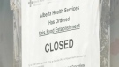
Calgary halal stores closed by AHS can now reopen
Alberta Health Services (AHS) says all of the uninspected halal meat found at several Calgary businesses has been destroyed and the affected facilities are cleared to open.
-
Bridal shop serving Calgary 54 years ends tradition, unveils new plan
As wedding dress styles change through the decades, one Calgary shop has remained a constant option for local brides for more than half a century.
-
Spring cleaning: Calgarians rolling up sleeves for annual litter pickup
Thousands of Calgarians are set to lend a hand in the city’s annual effort on Friday.
Edmonton
-
 WEATHER
WEATHER Josh Classen's forecast: Sunny end to a wet week
Light wind, some sun and a warming trend for the Edmonton area today and Saturday.
-
Alberta government to amend bill granting it sweeping powers over municipalities
The Alberta government, in the face of mounting criticism, says it will make changes to a bill that gives Premier Danielle Smith and her cabinet unfettered power to overturn local bylaws and fire mayors and councillors.
-
'I'm coming here every day': Edmonton shoppers lukewarm on Loblaw boycott
A campaign that started online has many Canadian shoppers promising to boycott Loblaw companies in May, but a local expert says the boycott is unlikely to take off.
Regina
-

Sask. Party votes down NDP motion to cut provincial gas tax
Saskatchewan motorists won’t be getting an immediate 15 cent per litre break at the pumps as an NDP motion to cut the provincial gas tax was voted down by the Sask. Party on Thursday.
-
Sask. set to gather to remember Riders legend Jim Hopson
Saskatchewan Roughriders past and present along with many friends, family and fans from around the CFL will gather in Regina Friday afternoon to remember the late Jim Hopson.
-
Sask. harm reduction workers feeling the effects of 'recovery-based' strategy
Three months since the Government of Saskatchewan stopped funding single use pipes and needles for safe consumption sites – those working on the ground with people battling addiction say the effects are clear.
Saskatoon
-

'Healthy, happy calves': Cow gives birth to rare set of quadruplets in Saskatchewan
A Saskatchewan family won the bovine lottery after their cow gave birth to a rare set of quadruplets.
-
Sask. Party votes down NDP motion to cut provincial gas tax
Saskatchewan motorists won’t be getting an immediate 15 cent per litre break at the pumps as an NDP motion to cut the provincial gas tax was voted down by the Sask. Party on Thursday.
-
'Absolutely necessary': Snow, rain easing concerns for Sask wildfire season, farmers
If April showers bring May flowers, then what does snow in May bring?
Vancouver
-

Quebec man charged with 11 counts of fraud in B.C.'s Lower Mainland
A Quebec man is facing 11 counts of fraud connected to incidents across B.C.'s Lower Mainland, Surrey Mounties say.
-
Princess Anne to take part in B.C. ceremony bringing new ship into Pacific fleet
Western Canada's first Arctic and Offshore Patrol Vessel will officially be brought into the Pacific fleet today and Princess Anne, the sister of King Charles, is scheduled to take part in its commissioning ceremony.
-
Top court orders new trial for francophone B.C. man who was not given French option
The Supreme Court is ordering a new trial for a francophone man in British Columbia who says he was not informed of his right to have a trial in the official language of his choice.
Vancouver Island
-

Princess Anne to take part in B.C. ceremony bringing new ship into Pacific fleet
Western Canada's first Arctic and Offshore Patrol Vessel will officially be brought into the Pacific fleet today and Princess Anne, the sister of King Charles, is scheduled to take part in its commissioning ceremony.
-
Magnitude 4.8 earthquake recorded west of Vancouver Island
A 4.8-magnitude earthquake was reported west of Vancouver Island Thursday evening.
-
Top court orders new trial for francophone B.C. man who was not given French option
The Supreme Court is ordering a new trial for a francophone man in British Columbia who says he was not informed of his right to have a trial in the official language of his choice.


